Movement Analysis
We have created a toolbox for the free GIS software OpenJUMP that allows to analyse movement data, called OpenJUMP HoRAE - Home Range Analysis and Estimation (pronounced: hooray). The software is and can be freely distributed under the General Public License verison 2.0 (GPL) - so you can give it to your co-worker or even modify it.
Contents
About the Home Range Analysis Toolbox
The toolbox contains functions for visualization of movement tracks and allows the creation and analysis of animal home ranges. Home range estimation methods that have been implemented are (see also the article below):
- Minimum Convex Polygon (MCP),
- Kernel Density Estimation (KDE), methods: (a) href, (b) LSCV, and (c) ad-hoc (region split)
- Line-based KDE, scaled and un-scaled
- Brownian Bridges
- Line Buffer
- Local Convex Hulls (LoCoH), methods: radius r, k-1 nearest neighbors, alpha region.
Additionally one can:
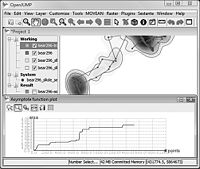
- Perform an asymptote analysis for MCP, Point-KDE, Line-Buffer
- Calculate core areas
- Classify home range parts
- Derive the skeleton for a home range region.
- Analyze the daily travel
The toolbox was originally developed to analyse location data from grizzly bears (ursus arctos) collected with GPS collars within the Grizzly Bear Programm of the Foothills Research Institute (FRI, Alberta, Canada). Funding was provided by Canadian Phase IV GEOIDE grant (#3).
Download
The software should run on Windows and Linux systems. MacOSX users can use the same version for download but a bug prevents saving to a database. Saving to a file does work. Anyway - here to the downloads:
- download software (ca. 42 MB)
- install instructions - note, the software requires Java Runtime Environment (JRE) installed
- a short article (pdf) that describes the functions of the toolbox (1st Version). It has also been published in 2012 in the Wildlife Society Bulletin)
Some preliminary results for a comparison of the estimators with grizzly bear data: GIScience 2010 extended abstract (pdf) and poster (pdf).
A test dataset with 14 GPS points to check out the functions of the toolbox is shipped with the distribution and can be found in the folder "/testdata/".
MacOSX users please read: MacOSX Users Short Installation Guide - at the end we also say what keys are important for context menu access.
Documentation
The revised version of the user manual for OpenJUMP HoRAE (Feb 2013) is here: download. It is also included in the software distribution. (Important: In the 2011 Version was an error in the core area calculation description; but not in the calculation.)
The manual describes only use of the software. For more background information on the methods we recommend to have a look at the ABODE manual since most functions implemented were "inspired" by the ABODE toolbox (but software calculations are differently).
We are also work on a wiki page with some online documentation. We had a start with this page: Home Range Calculation Manual, but it needs to be revised. We created a wiki page describing Problems with the HoRAE Toolbox.
Other supporting documents:
- Steiniger, S. (2009, unpublished): A vector-based algorithm to detect core, edge, patch and corridor areas and comparison with its raster-based complement. (pdf) --- The document explains the different types of classes such as core, edge, patch and corridor that can be derived with the function
MOVEAN>HRE Analysis>Extract Core, Patch, Edge; and:MOVEAN>HRE Analysis>Extract Corridors. - Steiniger, S., Hunter, A.J.S. (2013): 'A scaled line-based kernel density estimator for the retrieval of utilization distributions and home ranges from GPS movement tracks.' Ecological Informatics 13:1-8. (pdf) --- The document explains how the line-based Kernel Density Estimator (Line-KDE) works and compares it with Point-based KDE and the Brownian Bridge (BB) estimator. The function is to be found under
MOVEAN>HRE>Line KD>....
Support
If you have questions on the use of OpenJUMP HoRAE you can post to our user list at Google Groups:
Please note, that you need to login or subscribe first to send a message.
Loading Your Data
Currently we have no special GPS file loaders and our input files for testing have been Shapefiles (though there is a GPS extension for OpenJUMP). If you have problems to get your data into OpenJUMP, then please write us (to Stefan). Also, if you need to create the "unique days" attribute and you don't know how - let us know, so we can write a guide. There is no guide on that yet, because we had only pre-processed data and the unique days were generated with a Matlab script and not with an office application.
related:
Contact
You can contact me, Stefan Steiniger, writing an email to sstein(=at=)geo.uzh.ch. Alternatively you may contact Andrew Hunter.
Future Development & Bug Reporting
There are several ideas for future developments (e.g. to evaluate co-occurrence for two individuals). However, currently we don't have funding for that. If you wish a specific function in the toolbox, then it should be possible to implement that when you can provide funding. However, bug fixing is free of cost and depends on (my) free time. If you find a bug, then let me (Stefan) know. As the source code is freely available - others can do feature development and bug fixing too. Please let us know if you want to contribute, need help, or even write how you use HoRAE.
