Difference between revisions of "Movement Analysis"
(→Download) |
(→Download) |
||
| Line 24: | Line 24: | ||
* [http://www.geo.uzh.ch/~sstein/ojhorae/notes.txt install instructions] - note, the software requires [http://cds.sun.com/is-bin/INTERSHOP.enfinity/WFS/CDS-CDS_Developer-Site/en_US/-/USD/ViewProductDetail-Start?ProductRef=jre-6u22-oth-JPR@CDS-CDS_Developer Java Runtime Environment (JRE)] installed | * [http://www.geo.uzh.ch/~sstein/ojhorae/notes.txt install instructions] - note, the software requires [http://cds.sun.com/is-bin/INTERSHOP.enfinity/WFS/CDS-CDS_Developer-Site/en_US/-/USD/ViewProductDetail-Start?ProductRef=jre-6u22-oth-JPR@CDS-CDS_Developer Java Runtime Environment (JRE)] installed | ||
* a short [http://www.geo.uzh.ch/~sstein/ojhorae/oj_horae_sstein_v1_wiki.pdf article (pdf)] that describes the functions of the toolbox (article under submission) | * a short [http://www.geo.uzh.ch/~sstein/ojhorae/oj_horae_sstein_v1_wiki.pdf article (pdf)] that describes the functions of the toolbox (article under submission) | ||
| + | |||
| + | finally some preliminary results for grizzly bear data: [http://www.geo.uzh.ch/~sstein/manuscripts/sstein_gb_homerange_estimation_final.pdf GIScience 2010 extended abstract (pdf)] and [http://www.geo.uzh.ch/~sstein/manuscripts/sstein_giscience2010_hre_eval_v2_pdfscreenprint_lowres.pdf poster (pdf)] | ||
== Documentation == | == Documentation == | ||
Revision as of 14:03, 12 July 2011
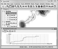
We have create a toolbox for the free GIS software OpenJUMP that allows to analyse movement data, called OpenJUMP HoRAE - Home Range Analysis and Estimation.
About the Home Range Analysis Toolbox
The toolbox contains functions for visualization of movement tracks and allows the creation and analysis of animal home ranges. Home range estimation methods that have been implemented are (see also the article below):
- Minimum Convex Polygon (MCP),
- Kernel Density Estimation (KDE), methods: (a) href, (b) LSCV, and (c) ad-hoc (region split)
- Line-based KDE, scaled and un-scaled
- Brownian Bridges
- Line Buffer
- Local Convex Hulls (LoCoH), methods: radius r, k-1 nearest neighbors, alpha region.
Additionally one can:
- perform an Asymptote analysis for MCP, Point-KDE, Line-Buffer
- Calculate core areas
- Classify home range parts
- derive the Skeleton for a home range region.
- analyze the daily travel
The toolbox was originally developed to analyse location data from grizzly bears (ursus arctos) collected with GPS collars within the Grizzly Bear Programm of the Foothills Research Institute (FRI, Alberta, Canada). Funding was provided by Canadian Phase IV GEOIDE grant (#3).
Download
- download software (package including OpenJUMP 1.4 with the HoRAE toolbox)
- install instructions - note, the software requires Java Runtime Environment (JRE) installed
- a short article (pdf) that describes the functions of the toolbox (article under submission)
finally some preliminary results for grizzly bear data: GIScience 2010 extended abstract (pdf) and poster (pdf)
Documentation
We work on a wiki page with some more online documentation. However, the ABODE manual may be a good start, since most functions implemented were "inspired" by the ABODE toolbox (but softwares calculations are differently). For now you may check our Home Range Calculation Manual, which contains some info on how using our toolbox.
Contact
You can contact me, Stefan Steiniger, writing an email to sstein(=at=)geo.uzh.ch. Alternatively you may contact Andrew Hunter.
